Wednesday, November 16, 2011

South Rim Trail at Tallulah Gorge State Park, Georgia

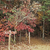
You haven’t really seen Tallulah Gorge unless you’ve hiked [or walked] both the North Rim Trail and the South Rim Trail.

If you begin your Gorge visit at the Interpretive Center, it’s likely you’ll start with the North Rim Trail. Since it’s right out back! Click here for CarolinaConsidered’s interpretation of that trail, if you haven’t seen it already.

For me, the South Rim Trail was a very different experience. Not better or worse; just different. So be sure to reserve time for both during your visit.

There are at least two ways to approach the South Rim Trail. The quickest would be from the end of the North Rim Trail, the one closest to the Route 441 bridge.

Just keep walking. And you’ll see a sign directing you to steps that will take you to the bridge’s sidewalk, and on over to the other side.

This bridge, by the way, is the second to span the gorge here, replacing one that opened in 1939. Before that, traffic on the way to Atlanta were forced onto the one-lane track on the top of the dam itself! A long-time friend raised in Western North Carolina recalls family auto trips to Atlanta in pre-bridge days. They sometimes had to drive across the top of this dam in the dark, scared to death that some huge truck would enter the path on the other side, forcing them to back precariously to the end of the dam. On one side they risked a slide into Tallulah Falls Lake; on the other a longer drop down the side of the dam and into the Gorge. Oh my!

I chose a different approach to the South Rim Trail, however. Driving the next day over to the Day Use Area on the shore of Tallulah Falls Lake. It’s certainly possible to hike both trails in one day. Or even half a day. But what’s the advantage of that? I’d recommend a slower pace that will allow you to enjoy the spectacular views along both trails. True, they’re both only about 3/4 miles in length. And fairly level. But I took over three hours on each and certainly had a better time.

I found plenty of parking in the Day Use Area. A construction crew was building a new comfort station beside the lake. All sorts of colorful equipment!

The beach here was closed during my visit. But a click on the photo above will give you an idea of what you’ll find once the trail there reopens.

Walk back up the Day Use Area hill, across the bridge, and over to the entrance of the South Rim Trail.

From there it’s one spectacular scene after another. It’s impossible to resist the temptation to see what’s beyond the next turn in the trail. I did manage to resist the temptation to descend these wooden stairs that lead to the suspension bridge across the Gorge.

Look at this! 680 steps down; and 680 steps back up. Beyond my ElderHiker capabilities. But what a view it must be! Maybe some day …

There’s much more to see here. But again, we’re running out of time. Since Picasa photo folder links seemed to work well in previous posts, I’ll add another here. Just click the “Slideshow” button near the upper right of the screen and enjoy.

Tallulah Gorge South Rim Trail

So there you have it. A visit to Georgia’s Tallulah Gorge State Park. A considerable distance from Columbia, South Carolina. But worth it!

Sunday, November 13, 2011

Hiking Georgia’s Tallulah Gorge North Rim Trail

After viewing the Interpretive Center’s fifteen-minute film – an excellent introduction to the whole Park – step out onto the Center’s beautifully designed back patio.

Interpretive Center Rear PatioHere’s just one of the views you’ll find out there. Then walk down the short path that leads to the North Rim Trail itself.

Oh, and don’t forget the native plant garden on the other side of the patio. The Park’s Friends Group maintains it. You may be surprised by what is and what isn’t considered native here.

03 stairs to 1From behind the Interpretive Center it’s convenient to turn left and walk a quarter-mile or so to these stairs. They’re really not as steep as they look in this photo. They’ll take you over to Outlook Number One. About the best place for ElderHikers to view the Gorge.

North Rim Wallender Tower SiteOn the way, you’ll pass the remains of an iron tower used in 1970 by 65-year-old Karl Wallenda to anchor his tightrope across the gorge on the north side. The highwire stunt drew quite a crowd, and was credited with increasing tourism in this area. Why in the world this beautiful place would need such a boost is beyond my comprehension. But here are the remains of the tower, anyway.

Once you’ve looked up and down the Gorge from the Outlook Number One viewing platform, give serious thought to hiking up to the benches you see above. I resisted the temptation, in the event. But imagine the view from there! Said to be the best in the Park.

This brings up an important feature of this trail. Especially for those of us no longer quite as mobile as we once were. Tallulah Gorge’s North and South Rim trails offer opportunities for most every visitor. From those of us who now need wheeled vehicles to get around — scooters or wheelchairs — to those intense exercise enthusiasts with carabiners clanking from their belts who pass us by in search of slippery vertical rock faces to climb.

Comfortable part of North Rim TrailQuite near the Interpretive Center on this North Rim trail you’ll even find a section paved with recycled rubber tires! This creates a surface that’s easy on ElderHikers’ knees, but solid enough for scooter or wheelchair tires.

An Unexpected Resting SpotEasy access doesn’t end with this rubberized section of trail. There are plenty of areas with smooth hard-packed dirt surfaces like the one you see above. All to the advantage of the ElderHiker.

There’s plenty more to see on this North Rim Trail. So, have a look at more photos in the Picasa slideshow below.

Tallulah Gorge North Rim Trail

So there you have it. The North Rim Trail of Tallulah Gorge in Northeast Georgia. A beautiful place to visit. Especially in the fall.

Stay tuned to this channel, since we’ll visit the South Rim Trail in the next post.

Friday, November 11, 2011

Interpretive Center at Tallulah Gorge, Georgia

Tallulah Gorge Interpretive Center

When visiting Georgia’s beautiful Tallulah Gorge for the first time, make the impressive Jane Hurt Yarn Interpretive Center on the North Rim your first stop. This Center, if memory serves, is a cooperative project between Georgia’s State Park System and Georgia Power. Somebody with deep pockets must have been involved. And their money’s been well spent.

Tallulah Gorge Interpretive CenterHere you’ll find all sorts of useful information about the Gorge, the history of the surrounding area, flora and fauna, and most important, instructions for safely hiking the North and South rims of the Gorge. And safety is a real concern here.

03 awardsThe State Park System requires permits for visitors who plan to hike to the bottom of the gorge. 100 permits are issued per day, according to the sign. To protect the Gorge’s sensitive environment. And, I suspect, to keep track of visitors who decide to venture down all of those steps. In case someone has to be carried back out. I resisted the temptation to ask for a permit ….

06 plaqueNamed in honor of celebrated Georgia environmentalist, Jane Hurt Yarn [born in Greenville, South Carolina, by the way!], this 16,000 square foot facility itself is well worth a few hours of your time.

04 building back viewIt was designed and built by Bowen & Brown, an innovative North Georgia general contracting firm. They’ve managed to create a structure here that blends beautifully into the overall Gorge environment. No easy assignment! So, take time to walk around the outside before you go in.

Interpretive Center DisplayInside, they’ve managed to make their displays accessible to those of us who don’t get around as easily as we once did. Click the photo above for a better view of the ramped wildlife exhibits that occupy the center of the building.

Interpretive Center Wildlife DisplaysThe ramp is easier going down than up, especially for folks relying on wheels. [There’s an elevator between floors.] But either way, the exhibits are accessible. Now, who’d want to miss a close-up view of these two critters! [Click through the Picasa album below for some more.]

Gorge Area American Indian CultureDon’t miss the informative exhibits on both the top and lower levels of this facility. They’re really well done. Some, text-heavy enough to please even recovering academics like me.

Gorge Area Later European SettlersOthers relying on presentation of artifacts and reproduced period photos to project their information to the public. Now, if they only had a cellphone tour here, like the Town of Cheraw, South Carolina ….

And don’t miss the fifteen-minute film on the lower level. It provides a good introduction to the overall Gorge environment, perhaps best viewed just before venturing out on the North Rim Trail. More on that in the next post.

Interpretive Center Gift ShopA final impressive feature of this Interpretive Center is their gift shop. Now, we’ve all wandered through gift shops in similar facilities. Most of them pretty much alike. This one, though, is worth a few minutes of your time.

13 gift shop 2The items for sale are carefully selected and attractively displayed. Lots of local artists and craftsmen find shelf space for their creations here. They’re not offered at WalMart prices, to be sure. But you’re likely to find something worth taking home. So, don’t visit the gift shop until you’ve hiked the North Rim trail and are about to return to your car.

Click on the image below to access more photos of this impressive facility. This is the first time I’ve tried to include a Picasa link. So let me know if you have any difficulty with it. [JapanConsidered@gmail.com]

Tallulah Gorge Georgia Interpretive Center

Stay tuned since next we’ll tackle the North Rim Trail here at Tallulah Gorge.

Wednesday, November 9, 2011

Visit to Georgia’s Tallulah Gorge State Park

Table of Contents for This Series

This week the Mobile Studio is parked on Site # 38 at Tallulah Gorge State Park in Northern Georgia. What beautiful country! Similar in terrain and foliage to parts of South Carolina’s Oconee County.

A fellow camper who lives in the area told me this campground has a long history, one of the first built by Georgia’s state system. Like most older campgrounds, it shows its age.

But a welcoming and helpful camp host found my reservation, checked me in with no difficulty, and directed me to the site. She proved a great source of information about the surrounding area. What would we do without camp hosts!

Here you see site # 38, one of the campground’s pull-through locations. Campsites here are close together, many with a challenging grade. But number 38 was quite comfortable, and the nearby neighbors, fortunately, were quiet and peaceful. 

Each site has electricity and water. Trash cans are provided throughout the area. The bath house you see above is one of two that serve the entire campground. But it was cleaned regularly, and provided plenty of hot water. A blessing on chilly mornings.

14 camp 1Not long after I arrived and set up, what appeared to be a small National Guard unit arrived and began unpacking equipment. I was in the Aliner writing and didn’t pay much attention. But they certainly were well disciplined. Even for a National Guard military unit.

Fort Stewart Youth ChalleNGe Group TentsImagine my surprise when I learned that they weren’t a National Guard unit at all. They were a class from the Fort Stewart Youth Challenge Academy. Here to experience the Park for a few days before graduation. About 30 teens, boys and girls, who’ve decided to make a change for the better in their lives. What an impressive group! I’ve got to learn more about that program. They certainly were ideal camping neighbors.

Next stop, the impressive Jane Hurt Yarn Interpretive Center, and an ElderHike along the north rim trail of Tallulah Gorge. So stay tuned!

Click here to access the next post in this series.

Tuesday, November 8, 2011

Conversation with Mr. David Sides, Cheraw South Carolina’s Director of Tourism and Community Development

Late last month I had the opportunity to meet Mr. David Sides, Director of Tourism and Community Development for the Town of Cheraw, South Carolina.

As Mr. Sides’ job title suggests, he’s a busy fellow! Running – sometimes literally – from meeting to meeting; writing grant proposals and memoranda. Most anything you might think of to help present Cheraw’s remarkable history and beauty to the public. So I was glad to catch him.

We met on Wednesday morning in Cheraw’s Lyceum Museum. You' may be able to hear traffic moving along the street outside as we talk.

This building, by the way, is well worth a visit. Built in either 1820 or 1825, it served first as a chancery courtroom, then as a library and home of Cheraw’s Lyceum. Part of the mid-nineteenth century Lyceum Movement that brought public educational programs to towns like Cheraw.

During the War [Civil War, of course] it was a Confederate telegraph office, and then quartermaster’s headquarters for first Confederate and then Federal troops. It later served again as Cheraw’s Town Library once books lost to marauding Federal troops could be replaced. You may be surprised by its size when you visit. It was smaller than I expected. Like many 18th century and early 19th century public buildings.

I began as usual by asking Mr. Sides to tell us about his personal background, education, and early career. Have a listen:

It’s a delight to meet with a public information person actually has roots in the community he or she represents.

Mr. Sides has lived in Cheraw for over 30 years, knows a lot about it, and considers it home. His infectious enthusiasm for his “home town” is more than a job. And, his long experience in public outreach and advertising gives him the skills necessary to present what he knows about Cheraw from first-hand experience to the general public. A great combination.

We then shifted to Mr. Sides’ current responsibilities for the Town of Cheraw. One would think that tourism and community development would be two separate portfolios. But Mr. Sides explains here how they work together.

I was especially interested in the annual projects sponsored by Chamber of Commerce’s “Leadership Cheraw” program. It brought to mind a similar program in Greenville, South Carolina. Both of these communities, on different scales, reflect the results of such innovation-inspiring programs.

Cheraw, like many other South Carolina towns, has been hit hard by the loss of employment-generating textile plants in recent decades. So I asked Mr. Sides about the current business climate. Here is his reply:

Mr. Sides’ response helps explain what I’d been seeing while wandering around Cheraw and its environs. Determination to recover from recent employment loss; mobilization of existing physical and cultural assets to increase Cheraw’s appeal for potential new investors, tourists, and residents; and a general, difficult-to-define “get ‘er dun,” or what we used to call a “can-do,” attitude. Whatever it is, it’s working.

Finally, I couldn’t resist the temptation to ask about the Historic Cheraw Cellphone Tour I had taken earlier in the week. I learned from other sources in Cheraw that Mr. Sides had been involved in this project from the very beginning:

Here, he gives much of the credit for this innovative program that combines history and technology to a forward-looking Town Council and Town administrators. With prodding he did admit that he wrote and re-wrote the scripts, and was at True Blue Advertising when the project started. Mr. Sides, it seems, does effective PR for everyone but himself!

Thanks again, Mr. Sides, for taking the time to talk with CarolinaConsidered. Your work in Cheraw is an inspiration for other towns in South Carolina facing the need to innovate and recover.

If you had difficulty listening to the audio segments of the interview via the embedded players above, here are direct links to the files on the Libsyn site where they’re hosted.

http://traffic.libsyn.com/japanconsidered/01_Sides_intro_and_background.mp3

http://traffic.libsyn.com/japanconsidered/02_job_in_cheraw_and_activities.mp3

http://traffic.libsyn.com/japanconsidered/03_Cheraws_atmosphere_and_business_climate_and_retirement_place.mp3

http://traffic.libsyn.com/japanconsidered/04_Sides_cellphone_tour.mp3