Click here for the first post in this series.
The drive from the McKinney COE Campground to the Etowah Mounds Historic Site took about a half-hour this morning. Mostly through four-lane highway. Next time I’ll look for a more scenic route.
Though the route goes straight through the middle of Cartersville, Georgia. Cartersville is an inviting town. Home of the Booth Western Art Museum and the Tellus Science Museum, or Weinman Mineral Museum, among other things. Its historic district streets are lined with interesting-looking shops and restaurants. Tempting. But wait to stop and look around on your way back from the Mounds!
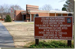 It was the Mounds I came to see. So I drove straight through. Slave to the GPS! And soon arrived at the front gate sign. Georgia’s Department of Natural Resources has maintained this Site since the early 1950s, when it was acquired by the State from the Tumlin family.
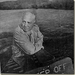 Henry Tumlin, pictured above, then served as Superintendent of the Site, and its protector, for thirty years, while continuing to farm the surrounding fields. He was a dedicated conservator, following the example set by his grandmother, Georgia Secession Roberts Tumlin. Click here for information about the Site when it was known as the “Tumlin Mounds.”
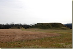 During your first visit, If possible, go straight back through the hallway to the left of the reception desk [after paying your modest admission fee, of course!] and out the back door. Then walk straight back along the path toward the Mounds. For the view you see above.
These are Mounds A and B. A on the right; B on the left. They’re quite a spectacle viewed from this angle. And give what to me is the best introduction to the overall Site and what you will see and learn while here. This clearly was an important cultural center. One worth learning more about.
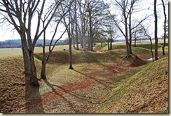 Then cross the small bridge over a fairly deep ditch, or defensive moat. Estimated to have been up to 10 feet deep. This moat continues in both directions clear around the core of the Site, down to the river’s edge on both sides. According to the nearby sign, archeologists have found evidence of a 12-foot high log palisade throughout its length, complete with watch towers.
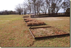 These planting boxes lie just beyond the moat. Stop to look closely and read the signs. Each box contains plantings of the grasses and plants that covered this area before the arrival of Europeans. Grasses native to northwest Georgia. There eight or nine types growing here. DNR hopes eventually to cover the whole site with them.
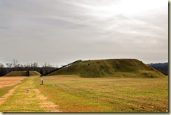 Then continue along this path toward Mounds A and B. By now you can see the spots here and there on the side of Mound A more clearly. They are tree stumps. Some of them huge. A year or so ago, after much controversy, DNR decided to remove all of the trees on the steeply sloped mounds. Created quite a stir at the time, I was told!
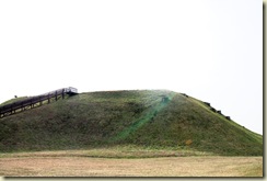 Don’t miss the opportunity of walking up Mound A’s steps that you see in the photo above. There are 150-some steps to the top, if memory serves. But the view is worth it. The mound originally included a 22-foot-wide stairway made of logs and clay, according to one sign. Today’s steps make for a much easier climb.
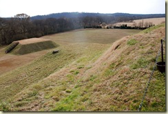 There’s another way to the top of Mound A. Though it isn’t open to the public. It’s a ramp with a switch-back half-way up at the rear of the mound. It may be difficult to see in the photo above. It was taken from the rear edge of the mound, looking down across the ramp. An interesting feature I’d like to know more about. In the background you can see the more regular features of Mound C. More on that in a moment, and why its features are so much more regular.
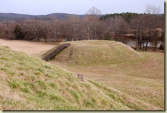 You may recall that the Ocmulgee site had both a main mound and a nearby smaller mound. Well, the same pattern has been followed here at Etowah. This photo is of Mound B, taken from the top of Mound A. Probably, in its day, grand real estate. But nowhere near as grand as that atop Mound A. Archeologists have found evidence of buildings atop Mound B too. Called “Structure 3.” With a diameter of around 42 feet.
That’s all we have time for now. But stay tuned as we continue our tour of the impressive Etowah Mound Site in the next post.


No comments:
Post a Comment