Thursday, October 29, 2009

Modoc COE Campground. Part III

Click here for the first post in this series.

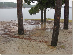
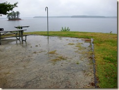
Tuesday, as forecast, it rained like the dickens. Beginning late Monday night. So, Tuesday turned into an in-Aliner day. With a quick car trip planned to visit one of the local museums if the rain let up in the afternoon.

(click photos for larger images)

Rain Front Maybe it’s a syndrome found only among former tent campers. But for some reason, I really enjoy rainy days and nights in the Aliner.

Rain Side Could it be those memories we all have of soggy tent floors and gear? Leaking seams? Wet-to-soaking bedding? Compared with protection from all that by the solid walls, floor, and roof of the Aliner? Including all the heat, cooling, and ventilation anyone could desire?

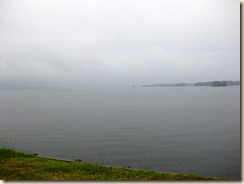
Rain on LakeThough we’re still able to watch the rain and wind brush their fleeting designs across the surface of the lake? Must be something like that. Well, that and the nice sound the rain makes on the solid roof.

Plans changed suddenly later in the morning. With a phone call from home that required me to leave Modoc for one night to attend to family events.

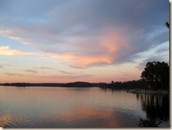
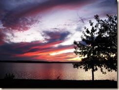
Sunset Wednesday 1 That attended to, I returned to Modoc and the Aliner late Wednesday afternoon. No more rain. But the partly cloudy sky made for a beautiful sunset not long after arrival.

Sunset Wednesday 2 Folks with cottages and houses here on the lake must get used to such displays. Or require a real corker of a sunset to coax them out onto their porches. For me, though, only an occasional visitor, the sunsets have been a nightly treat.

If you look closely at the first sunset photo above you’ll see the faint outlines of an interesting presence right on the tip of the other peninsula of this COE campground. A triangular shape.

That’s site # 11, the only “primitive” campsite in the park. Which means no electrical hookup or water. We’ll find out more about that unusual shape in the next post. So stay tuned.

Click here for the fourth post on Modoc.

Tuesday, October 27, 2009

Modoc COE Campground. Part II

Click here for the first post in this series.

Today has been an out-and-about day. Hard to leave site # 30, and these beautiful views of Lake Thurmond. But adventure awaits.

This area of South Carolina, right next to Georgia, is chuck-full of interesting places to visit. Some well marked. Others quietly awaiting the notice of more observant visitors.

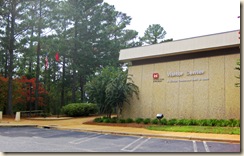
Visitor Center Front Today’s first stop was at one of the can’t-miss-it places. The Corps of Engineers Visitor Center for the J. Strom Thurmond Dam and Lake.

This impressive building houses the Corps’ administrative offices for the complex, including all of the campgrounds and day-use areas. As well as displays that interpret the surrounding natural environment for visitors. Lots of interesting information here. And room for more!

I stopped here a couple of years ago while camping at Modoc. The displays don’t appear to have been changed or refreshed in the interim. Probably due to budget and personnel constraints. So, even the Corps has budget constraints! Not as severe as the South Carolina state park system. But serious.

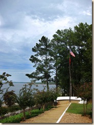
Flag Seating A few years ago, someone devoted considerable effort and resources to creation of this Center. Both to the specific displays, and to the building that houses them.

The building and grounds appear to me ideally suited to host waves of school children of all ages. As well as adults. Plenty of parking; plenty of seating and picnic areas for lunch. Even a playground with all sorts of sophisticated playground equipment.

No school groups were around today. But I hope they do visit at other times of the year. It’s a facility full of learning opportunities.

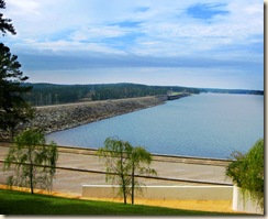
Dam Top The dam, of course, with its hydroelectric generators, is the main feature of the complex. Here’s a view of the dam on the lake side, taken from the porch of the Visitor Center. Be sure to click on the photo to see a more detailed view. It’s much bigger than it looks in the photo above.

Dam LowerThis is a view of the other side of the same dam. I’m not especially interested in large concrete structures. Probably because I know so little about them. But this one is beautiful. It’s hard not to stand and stare at the water from the lake gushing through the gates. While trucks and cars pass along the road at the top of the dam.

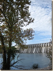
Dam Tree Here’s the same side of the dam seen through the trees planted along the shore of the river. Taken from the walking and picnic area maintained there by the complex. Together with the elaborately equipped playground.

A few more minutes viewing the dam, walking the paths, and inspecting the boat ramp that provides access to the Savannah River here, and off to post the previous blog entry.

That meant a drive either south to Martinez, Georgia, with all of its shops, restaurants, and traffic. Or north to McCormick, South Carolina. A town with far fewer shops and restaurants. And quite manageable traffic.

Well, Martinez [pronounced here with the accent on the first syllable!] is nice. Convenient for shopping.

But today I headed north toward McCormick. Up Route 221. More on stops along 221 in a later post.

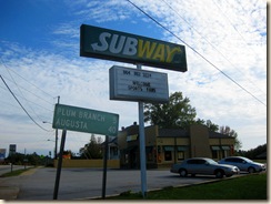
Subway at McCormick Longtime readers may recall my surprise a few years ago upon finding a WiFi connection at the Subway Sandwich shop in McCormick, South Carolina. Well, it’s still here, providing a strong signal for patrons with computers. As well as excellent sandwiches and personal-sized pizzas. There may be other WiFi clouds in McCormick. But I’ve yet to find one. The far-sighted Subway owners are leading the trend here!

McCormick is one of those old South Carolina towns with a strong sense of history. It will take at least one separate blog entry just to give an introduction. Maybe later this trip. Or the next.

Well, enough running around for today. It’s a shame to waste those beautiful views from site # 30. So back south on Route 221 to the Modoc Campground to spend some quality time outside in the reading chair, awaiting the sunset display over the lake.

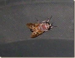
Fly Top The sunset display tonight wasn’t all that impressive. But I did have an interesting visitor. Especially for this late in the year. The huge fly you see above. I think it’s what we used to call a horsefly OverHome.

He buzzed the reading chair a couple of times. But took no interest in Elmer Kelton’s western novel. Then over to the Aliner. That too failed to hold his attention, and he landed at last on the front left tire of the car.

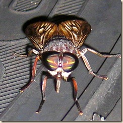
Fly Facing Here’s a candid head-on photo of this remarkable creature threatening to punch a hole in my tire!

More on Modoc Campground and the surrounding area tomorrow. Rain is forecast. Heavy at times. So stay tuned.

Click here for the third entry.

Monday, October 26, 2009

Modoc COE Campground, Part I

Table of Contents for This Series

Front Sign

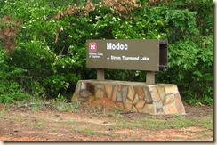
Camping two weeks in a row is excessive! But as it turned out, two of my favorite campsites came available this month at nearly the same time. One at Hunting Island State Park last week. And this week site # 30 on the Corps of Engineers campground at Modoc, South Carolina. Since this campground closes for the winter soon, I just had to take it. More on this particular site in a moment.

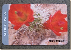
Senior Pass Corps of Engineers campgrounds have several advantages. Especially for older campers. Those of us over 62 are eligible to buy a National Parks and Federal Recreational Lands Senior Pass for $10.00. That Pass is good for life. No renewal necessary. So keep it in a safe place!

With this Senior Pass we get a 50 percent discount on the already low camping rates at all Corps of Engineers campgrounds. As well as valuable discounts at other federal recreation facilities.

Further, it’s convenient and economical to make reservations in advance on line. Through the National Recreation Reservation Service. They don’t charge all of those transaction fees, taxes, and so on that we find on our Reserve America bills. Those extra fees add up!

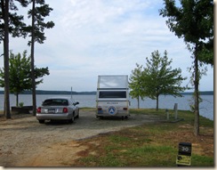
Site 30 From Road Result? Here I am for five nights on one of the nicest campsites in South Carolina, if not the entire Southeastern United States, for only $55.00. That’s $11.00 per day! For everything!

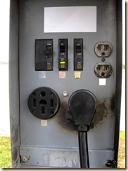
Fifty Amp This site even has the 50-amp electrical service required by big motor homes.

Another advantage of Corps of Engineers campgrounds is their ample budget. Well, “ample” is a relative term. The Corps’ campground budget faces pressure every year in Washington. But they’re still much better off than South Carolina’s state campgrounds.

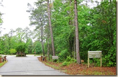
Front Gate This allows them to hire the personnel necessary to maintain their facilities. Both for daily routine maintenance, and for the essential non-routine larger jobs, such as tree pruning and road repairs.

I encounter few government organizations that consider current funding sufficient to accomplish their missions. If they did, their managers would expand their missions and ask for more funding! But relatively speaking, the Corps campgrounds have a budget advantage over their South Carolina state neighbors.

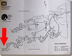
Map of Campground Now, what’s so unusual about this particular site? Well, the simple campground map you see in the photo above will give you an idea. Click on it for a better view.

This COE campground is situated on two long, narrow finger-like peninsulas that extend out into J. Strom Thurmond Lake. Another of those huge man-made lakes created some time ago by the Corps for energy and conservation purposes. I don’t think this one is quite as large as Lake Murray. But it’s very big.

As you can see on the map, site # 30 is right on the tip of the southern peninsula of the campground. Meaning it has complete water and lake views on three sides! With some pulling and hauling, I’m able to maneuver the Aliner so its front window points directly out into the lake.

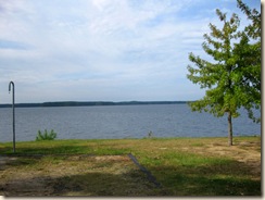
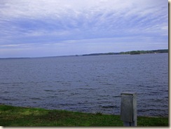
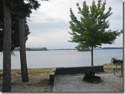
This gives impressive lake views on three sides as I sit here at the computer.

Front View One of the distant shore directly out the front window.

Right View One of the lake extending toward the horizon out the right side.

Left View And one of a nearby small island used only by geese and the occasional resting kayaker from the left side. And the shore beyond with its privately owned “cottages.” You can imagine the sorts of houses built along this shore.

Now, there are a couple of disadvantages to site # 30 as well. First, it offers little shade. The Park folks have planted a few trees around the site that have grown considerably during the years I’ve been coming here. But they have a ways to go before they provide much relief from the sun.

So, in the hot summer months your rig on site # 30 will be in nearly full sun for much of the day. A challenge for our air conditioners in South Carolina climate during the summer months.

The second challenge is wind. And that’s year-round. When winds on the lake reach 20 or 30 miles per hour, this site gets its share. Large Class A motorhomes find the broadside wind a challenge. Even without their awnings extended. And awnings are likely to be damaged or blown down if they are left out. There are sites in this park better protected from the wind on either side of these peninsulas.

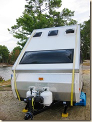
Wind Straps Fortunately, this little Aliner does quite well in winds that discourage the larger rigs. It doesn’t have slide-outs, of course. Nor any built-in awning. With its stabilizer jacks, two colorful wind straps in place outside, and the side-to-side pole bracing from the inside at the very top of the A, it doesn’t mind the wind. Even side winds. 20 and even 30 mph winds are no problem at all. Of course, there’s a limit!

More on this campground and the surrounding area tomorrow. Click here for the next entry.

Thursday, October 22, 2009

Hunting Island State Park, SC. Part IV

There’s much more to Hunting Island State Park than the RV and tent campgrounds at its northernmost end. Most folks who visit this Park spend time at its other facilities.

This is the fourth in a series of posts on this Park. If you missed earlier ones, click here for Part I, here for Part II, and here for Part III.

(click photos for larger images)

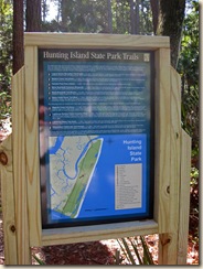
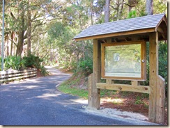
Trails Sign A Visitor’s Center, cabins, a famous light house, winding hiking trails, and acres of beautifully tended sandy beach. The trails I’ve walked here, by the way, have been very well maintained.

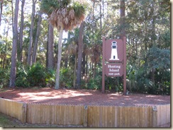
Light House Sign So, late this morning, off I went to look around and take a few photos. Turn left out of the campground road and drive nine-tenths of a mile to arrive at the sign you see above. It’s on the left side of Route 21, as you drive toward Fripp Island. This really is the Park’s main entrance.

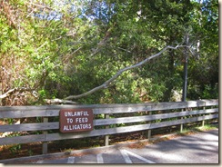
Once past the sign you enter a winding paved road that provides on both sides an excellent introduction to the plant life of Hunting Island. Trees, vines, flowers. All in incredible array. Pulling one of those huge travels trailers through here would be a challenge. At least for me! Alligator Sign Once past the gate at which fees are collected, and some more winding roadway with beautiful scenery on both sides, you will arrive at the parking lot for the Visitor’s Center. And the sign cautioning against feeding the alligators attached to the fence on the opposite side of the road.

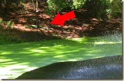
Pond and Turtles Hmmm. Could there actually be alligators in this pond on the other side of the fence? If so, it’s a pretty flimsy-looking fence! At least there are turtles in that duck weed-covered pond. Some fairly large …

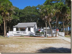
Visitor Center Front Hunting Island has the most impressive Visitor’s Center building I’ve seen at a South Carolina State Park. Now, I’ve yet to visit every Park. But this is the the most impressive so far. From the long, winding walkway, elevated above the aforementioned pool. To the wrap-around porch where visitors can sit comfortably and view the surrounding plant and animal life.

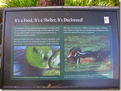
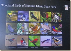
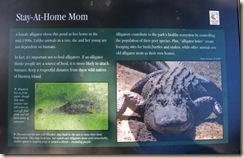
Duckweed SignBirds Sign With informative signs throughout. Alligator Information And even another alligator sign. Including warnings against feeding them.

South Carolina’s natural resources folks recently have been using an excellent saying, “A fed alligator is a dead alligator,” in their campaign to discourage visitors from feeding them. For reasons explained in the sign above. It makes the point!

Hmmm. I wonder if they’re really serious about this alligator thing around here ….

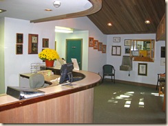
Inside Visitor Center 1 Inside, there are comfortable offices for attendants and Park officials. And sophisticated audio-visual equipment. Displays along the walls describing the history of the Park and the light house. Take you time in here and you’ll learn a lot about the area.

An Alligator Then back out to the car. One last look across the duckweed pond, with its fountain in the center. Click the photo above and look carefully.

Yup! There she is! Enjoying the sun out on the bank. So, the signs warning of alligators weren’t jokes or promotional stunts after all! Use reasonable caution throughout the Park, and all will be fine. What a nice sight.

Sign and road Drive out from the Visitor’s Center, following the signs, to reach the Light House area.

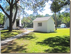
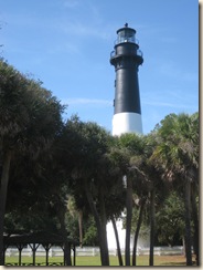
Lighthouse Complex This really is the central feature of this Park. The investment of resources here shows to good advantage. Last weekend the Park celebrated the 150th anniversary of this light house. So everything is spic and span. A new coat of paint on the light house itself. The surrounding buildings tidied up and painted.

Light House It’s quite a sight. And imagine! It’s been moved from its original site to a ways inland. Due to beach erosion! What a job that would be. More energetic folks pay a small fee and climb to the top. They report a spectacular view from up there. I’ll take their word for it.

Light House Beach Last time I was here the beach area had taken quite a beating in a recent storm. That’s all been cleaned up now. What a place for a stroll on the beach.

Gift Shop Even the gift shop and snack bar complex appear to have been spiffed up for the 150th anniversary crowd. They’re rumored to sell ice cream …

So there you have it. Well, part of it, anyway. Time to move on. But I’ll be back soon. And hope you too can visit to see for yourself. But, don’t feed the alligators …

Tuesday, October 20, 2009

Hunting Island State Park, SC. Part III

Click here for the first post in this series.

What a day! After a morning of writing, reading, and soaking up the atmosphere of this incredible campground, around 11:15 a.m. I drove toward Beaufort in search of a public WiFi connection.

The closest is about seven miles back along Route 21. In front of the St. Helena Island branch of the Beaufort County Library. This library branch is housed in a primary school building. And therefore doesn’t open until 3:30 p.m. on weekdays. It’s wireless signal is strong enough, though, to reach clear to the side of the road!
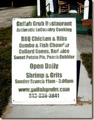
GG Sign After checking e-mail and news, and posting a couple of new blog entries, I continued on Route 21 toward Beaufort to the Frogmore intersection, and stopped at the “Gullah Grub Restaurant” for lunch.
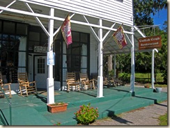
Gullah Grub FrontNow, owner Bill Green hasn’t invested huge resources in this restaurant’s facade.
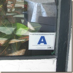
A Rating There are a few signs, and a porch with several inviting rocking chairs. And the “A” rating displayed in a side window, almost as an afterthought.
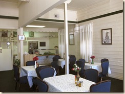
GG Interior 1 Once inside, though, it’s a different story. Comfortable chairs, and tables covered with functional tablecloths. Each with a flower arrangement, salt and pepper, and a bottle of hot sauce, neatly arranged. Now, that’s not unexpected. Just unpretentious, functional, and, of course, spotless.
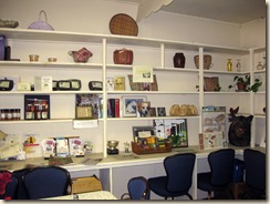
Wall Display 1 But as you wait for your food, take time to look at the displays on the walls. These aren’t decorations. They’re displays! Every square foot of wall space in this restaurant is devoted to providing information about some aspect of Gullah culture. Tastefully, unobtrusively.
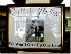
Gullah Land SignViewed thoughtfully, this dining area is as much classroom as restaurant! Basketry, wood carving, pottery, agriculture, and the African roots of Gullah arts and crafts. All described here, with examples.

Fox Hunting Display One whole section of the back wall is devoted to fox hunting.

“Fox hunting??? A fox hunting display in a Gullah restaurant?!” I can almost hear you ask.

Absolutely. I said the displays in this restaurant are instructional as well as ornamental! Gullah Grub owner, Mr. Bill Green, is Gullah Driver for the Middleton Hunting Club near Charleston. According to another display, that’s the oldest American hunting club with Gullah drivers.

Drivers have responsibility for dogs and horses, and determine its success or failure. They actually run the hunt. It’s not casual work. Gullah drivers have played this role for nearly 400 years. And Bill Green has passed these skills down to his sons.
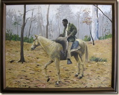
Horse Deer Yes, Mr. Bill Green is, above all, a man of the woods. A hunter. Most comfortable astride a horse, listening to the sweet music of hounds on a scent.

Not quite your preconceived image of a successful Gullah businessman in Frogmore, South Carolina? Certainly not mine, before I arrived. Well, the displays on the walls of Bill’s restaurant have served their purpose!

But before leaving Gullah Grub, I have to mention the food. It is, in a word, incredible. I ordered soup, fried fish, red rice, collard greens, potato salad, and iced tea.

This isn’t “short-order” cooking. It’s done per-order, and takes a few minutes. And it isn’t cheap! Not Charleston prices, by any means. But not typical roadside meat-and-three prices either! Don’t worry. You’ll be glad to pay once you’ve tasted the food.

The tea comes first. Fresh-brewed and clear. Just the kind of iced tea you wish you could make at home. With a square of corn bread.

Be very, very careful with that corn bread. It too, like everything else in this restaurant, is carefully made. Tin by tin. Not by the square yard. Incredibly good. And, if you should finish one square, another appears magically from the kitchen. Now, this is cornbread!

That’s the second “incredible.” But it’s deserved. Even required here.

Then comes the soup, fish, and all the trimmings. How long has it been since you’re eaten fried fish in any restaurant – regardless of price – without asking for the usual sauces to go with it?

Well, I’m unfamiliar with local Frogmore statutes. But it could well be at least a misdemeanor, if not a felony, to smear any sort of sauce on Gullah Grub’s fried fish. It comes perfect from the kitchen. And in just the right quantity. The same for everything else on the table.

All of this is the creation of Mr. Green’s daughter, Ms. Oshie. She is restaurant manager and chef. As well, when she has time, a delightful source of additional information about the displays on the walls, St. Helena Island, and Gullah culture in general.

Leaving Gullah Grub, full and impressed, I discovered Mrs. Jery Bennett Taylor, celebrated Gullah basket weaver, sitting in one of those comfortable chairs on the porch. But that chance meeting will have to wait for another post.
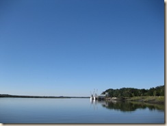
Coastal Seafood Back to Hunting Island State Park. Detouring down Eddings Point Road to check a public boat ramp.
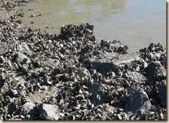
Oyster Bed It’s there, and nicely situated. But nearby oyster beds make me fear for the hull of my inflatable kayak.

More on Hunting Island and its environs tomorrow.

Click here for Part IV.
Monday, October 19, 2009

Hunting Island State Park, SC Part I

Table of Contents for This Series

  1. Drive down and initial impressions.
  2. Early morning walk around the Park
  3. Visit to the Nearby Gullah Grub Restaurant
  4. The Visitors Center and Light House

Up early yesterday to prepare for the trip to Hunting Island State Park. Weather was ideal for a long drive. Mostly sunny, but not oppressively hot.

This state park, located on a barrier island near Beaufort, is said to be the most popular in the whole South Carolina State Park system. Nearby Beaufort too is an old and interesting South Carolina town that I’ll write more about this trip, if time permits. But first the Park!

The drive from home is only about 170 miles. Most of it along four-lane interstate highways: I-26, I-77, and I-95. It’s also possible to avoid I-95 by continuing east on I-26 to the North Charleston area, there connecting with Route 17 South.

Route 17 too is a four-lane highway. But it’s much more interesting to drive. And gives the feeling of actually being in South Carolina. With its often unusual roadside shops, restaurants, and fruit and produce stands along the way. The signs alone are an experience! It also takes you right past the turn-off to Edisto Island!

Today, though, I took the shorter and quicker I-95 route. All the way south to Exit 33, and from there east on Route 21. Through Beaufort, toward Hunting Island. The interstates were surprisingly busy in both directions today. Quite a few motor homes and travel trailers. But not a single Aliner!

Over the bridge – well, bridges! – across islands with interesting names. Such as “Lady Island” and “St. Helena Island.” And finally on to the outermost, Hunting Island. Right on the shore of the Atlantic Ocean.

Hunting Island and the surrounding area, like Edisto, has a long and interesting history. Speaking of Edisto, It’s quite a ways from here, if you go by land. Due to the irregular South Carolina coast line in this area. But it’s only a few miles north by boat.

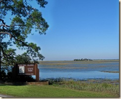
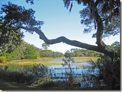
Main Sign Here’s a photo of the Park’s main sign. And the area surrounding it. Note the small island visible on the horizon. The clear water, and the marsh.

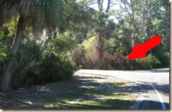
Camping Sign It’s easy to miss the turn into the campground if you don’t stay alert. It’s right across the road from that main sign. So, slow down and make the turn. Otherwise, as I did the first time, you’ll end up at the other end of the island and have to circle back.

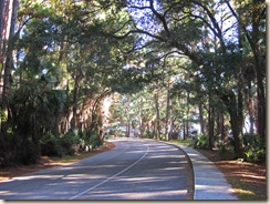
Entry Marsh The road into the campground is scenic and beautifully maintained. Slow down and look left just after the turn for a view out across the marsh through moss-draped live oaks. What a place!

Drive in Then proceed toward the office and gate. This sort of scenery doesn’t just happen. It must require intensive care!

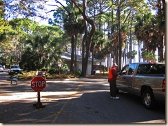
Volunteer Check-in I arrived at the Park gate at just around 2:30 p.m. Since this Park is so busy, volunteers help to check people in and out, standing at the entrance in front of the main office and store. They have over 200 campsites to keep track of. Today a South Carolina couple from the western part of the state, near Keowee-Toxaway State Park, were on duty.

But, for the first time ever, I had difficulty with a reservation made on-line. My reservation for site # 39, made some time ago, wasn’t listed on their sheet! Worse, someone else was already there and set up. Not good!

So, in to the office to try to straighten things out. It’s still not clear what happened. But it seems this reservation had been confused with a reservation for a later date at Lake Wateree State Park! Meaning I was out of luck for Site # 39.

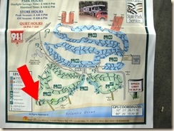
Campground Map However, all was not lost. One more ocean-front site just happened to be available. Number 51. Right at the southern end of the campground. See it marked with the arrow on the campground map.

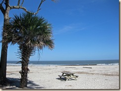
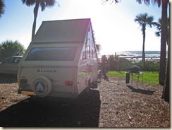
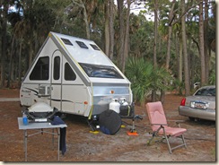
Aliner on Site It’s also a pull-through site. It doesn’t have quite as broad an ocean view, as you can see in the photos above.

Hedge But it does have the advantage of a sturdy barrier of plants and trees on its northern side. And plenty of shade. All to the good!

No difficulty pulling in. Or even turning the Aliner to face the ocean. That’s usually a real challenge in the soft sand of these beachfront sites.

Reading Chair Within a three-quarters of an hour the reading chair was out, facing the ocean, and I was enthroned with a good book! Anything closer to heaven would frighten an older person like me!

Click here for the next post.